
Is there any way on my Mac system that I can calculate driving distance between two cities? Planning a big Texas road trip…
Ah Texas. A state that doesn’t seem that large until you try to drive from one point to another, then you suddenly realize just how huge it is. Years ago I drove from San Antonio to Amarillo and that was a full day’s drive. No wonder people in Texas see themselves as having their own country! 🙂
But it turns out all that all the mapping programs and Web sites out there, from Google Maps to Mapquest to the Apple Maps application, can not only tell you how to get from your current location to a desired spot on the globe, but they can all also help you calculate distance between two points or cities, whether you’re driving, bicycling or trying to take public transportation.
Let’s use Apple Maps since you’re on a Mac. And while we’re at it, I’ll show you a few nifty tricks too!
To start, launch “maps” by finding the app in your Application folder. It’ll start up showing you your current location:
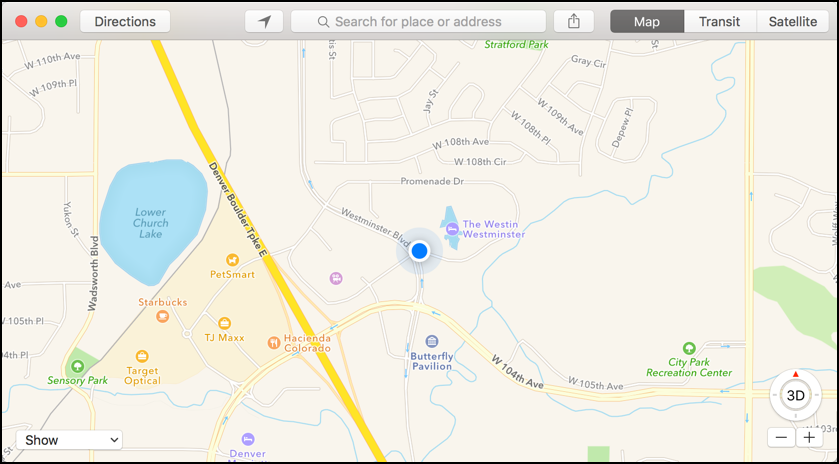
If it’s not showing you the right location, click on the triangle button on the top bar, just to the left of the address search box. Sometimes Apple Maps has a tendency to show you the last place you were, not the current, so knowing how to ‘recenter’ yourself is useful.
Heck, now that you know where you are, you might want to share this information with someone else. To do that, click on the share button, the box with the arrow coming out of it that’s just to the right of the search box.
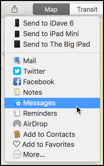
You can see that there are a lot of ways to share, including the ability to send that particular address — or directional information, once you’ve calculated directions — to your iPhone, iPad or other iOS devices. I’ll text my buddy Emily, so I’m going to choose “Messages”.
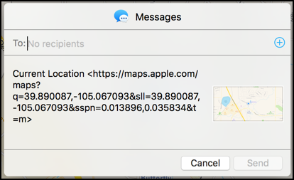
You can see, it’s pretty darn easy to share your location, whether you’re showing a friend that you really are at the White House or Disneyworld, or because you want them to be able to come and pick you up.
But you want directions from point A to point B, so click on the “Directions” button on the main Apple Maps window. It’s on the top left.
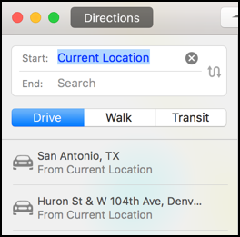
By default, it’ll use your current location as the starting point (which makes sense), and below it shows recent destinations I’ve searched, including San Antonio, Texas and an intersection in Denver, Colorado.
I don’t want to get directions starting from my current location, however, so I’m going to figure out how far it is from Austin, Texas to San Antonio, Texas instead. I can do that by simply typing in the name of the city in question:
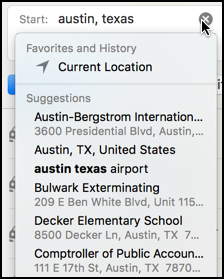
Notice that Apple Maps automatically shows matches from its database, including the airport, an exterminating company (weird!), a school, and the comptroller of public accounts office in downtown Austin. I’ll just choose “Austin, TX, United States”, an address that is probably city hall within the city.
Entering the destination address — San Antonio, Texas — and the process is identical, at which point Maps automatically shows me driving options on the map and displays turn-by-turn driving directions:
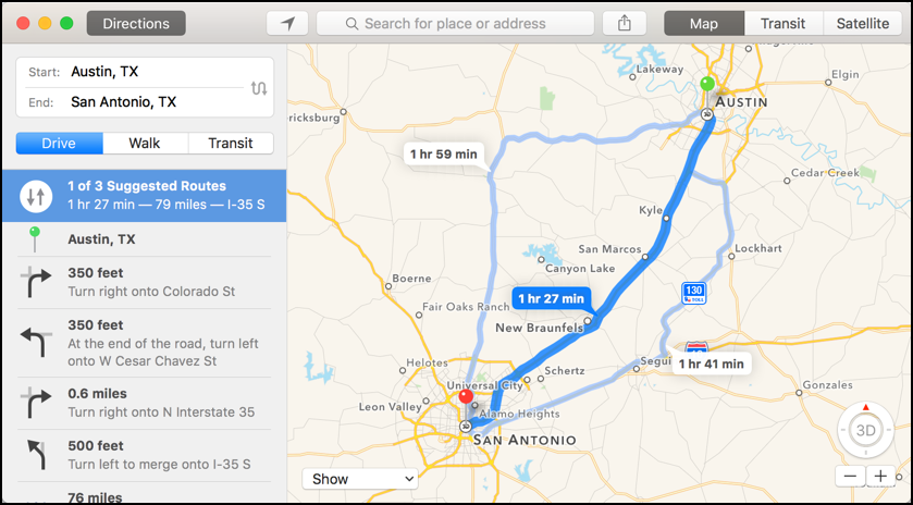
Look closely at the first box on the most direct of the driving routes and you’ll find that it’s 1 hr 27 minutes to drive between these two cities in Texas and that it’s a total of 79 miles.
There ya go. 79 miles between the center of Austin, Texas and the center of San Antonio, Texas. Now the specific distance between two points of interest in these cities could be different and if you wanted to take an alternate route that’ll add miles to the trip, but that’s the basic approach to finding out driving distance between cities in the United States or around the world. That’s how you can also ascertain, for example, that it’s 882 miles from Paris to Rome, or 870 miles from Cape Town, South African to Johannesburg, SA, or a whopping 1273 miles to drive from the northernmost city in Japan to the southernmost (Aomori to Kagoshima).
Oh, and back to Texas. If you’re curious and training for a marathon, you can also ascertain how long it would take to walk from Austin to San Antonio:
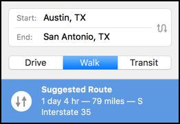
28 hours of walking? My suggestion: take the bus. 🙂
I live in Texas and found the easiest way to find anything in Texas is to use the free or paid version of the Waze App on my iPhone. It’s gotten me out of trouble quite a few times when Interstates were closed down due to weather or horrible accidents and took me through back roads I didn’t even know existed. I personally use the free version and it always works like a charm. It has a lot more to offer than just distance and it is much better in finding things than TomTom or any of the other GPS models out there. I’ve even used it in Mexico before.